Did you know PPS calculates fuel consumption for STAR level capping?
Enhance safety
in your preflight planning and let the PPS Flight Planning System (PPS) calculate correct fuel consumption for arrivals with flight level restrictions. Traditionally, preflight planning systems only take continues descend incline to airports into account – not calculating enough fuel for the extra fuel burn in lower flight levels.
Example of flight level restrictions at London City (RWY 09/27, JACKO 2L 1M) ODVOD FL220, JACKO FL90.

Figure 1: Extraction from a standard arrival chart (STAR). Source: Civil Aviation Authority, AMDT 14/2020
Example of STAR level capping (Step down technique)

Figure 2: Stabilized constant descent angle (SCDA) versus step-down technique.
Source: Transportation Safety Board of Canada.
How does PPS calculate?
In the preflight planning phase PPS calculate backwards from destination airport and automatically adjusts top of descend (TOD) accordingly to respect flight level restrictions in the arrival procedure (STAR and approach).
Updates flight level restrictions
Standard arrival procedures containing multiple step descents are known all over the world. From the US west coast to KIAD/IAD (Washington) in the east and in Europe at EDDF/FRA (Frankfurt), EGKK/LGW (London Gatwick) and EKCH/CPH (Copenhagen) just to mention a few. Our navigation department ensures that relevant navigation data is continuously updated in PPS.
In PPS v. 1.9 you can see the path displayed on the mini map and below flight level restrictions (in column Altitude). To access the view of restricted flight levels for any airport you can look it up in our databases. Go to DATA > Databases > Airports > Choose which airport under the tab: Airports and Runways > Select STAR, runway and enroute transitions and … contact our Support Team to get a full introduction.
Read more about PPS Flight Planning study our newly released integrated flight tracking and notification platform OpsControl | Flight Watch.

Related Articles

PPS X 1.1
PPS X Continues to Evolve with New Enhancements for Smarter Flight Planning AIR SUPPORT has already introduced PPS X, the next-generation version of PPS Flight Planning, designed to deliver greater efficiency, usability, and precision for today’s demanding aviation...

Data Reports
Individual Data Reports for Operational Needs Receive tailored, comprehensive data on fuel consumption, crew management, and other daily operations At AIR SUPPORT A/S, we specialize in delivering precise and comprehensive data solutions to streamline your aviation...
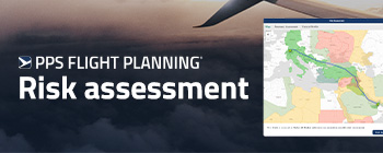
Real-Time Risk Management
Incorporating Real-Time Risk Management into an Airline Integrated OCC (IOCC) In the fast-paced aviation industry, ensuring both safety and operational efficiency is crucial for success. With the increasing complexity of flight operations and the need for timely...